

Right now, beneath thousands of feet of pitch-black, crushing water, there are mountains taller than the Himalayas, volcanoes erupting in slow motion, and creatures that science hasn’t named yet — and almost none of it has ever been seen by human eyes. The ocean floor unexplored reality is one of the most extraordinary facts about our own planet: we have mapped the surface of Mars in higher resolution than we’ve mapped the bottom of our own oceans. In 2025, the Seabed 2030 project confirmed that just 27.3% of the world’s seafloor has been charted to modern standards. That means nearly three-quarters of the ocean floor — an area larger than all of Earth’s continents combined — remains essentially unknown.
So why? We have rockets that reach other planets. We have satellites that track individual cars from space. Yet the ocean floor, right here on Earth, stays hidden. By the time you finish reading this, you’ll understand exactly why — from the crushing physics of deep-sea pressure to billion-dollar funding gaps, to the incredible new technologies racing to change that in 2025 and beyond.
makes exploration exponentially harder the deeper you go.
The Staggering Scale of What We Don’t Know
Let’s start with the numbers, because they are genuinely hard to believe.
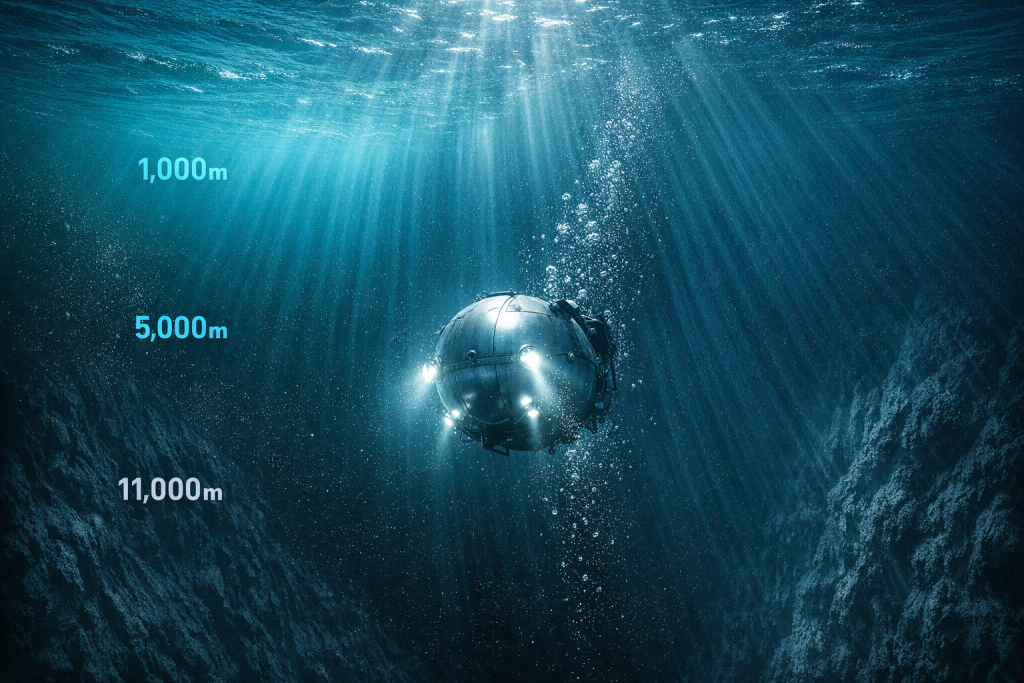
The ocean covers 71% of Earth’s surface. It holds 97% of all the water on the planet. Its average depth is around 3,688 meters — that’s nearly 12,100 feet. At its deepest point, the Challenger Deep in the Mariana Trench, the seafloor sits about 36,000 feet below the surface. If you dropped Mount Everest into that trench, its peak would still be more than a mile underwater.
Now here is the part that should stop you cold. A 2025 analysis of publicly available deep-sea dive data found that humans have visually explored roughly 0.001% of the deep seafloor. Not 1%. Not 0.1%. Point zero zero one percent. That’s not a typo. The entire visual record of humanity’s direct observation of the deep ocean floor fits into a fraction so small it barely registers.
Furthermore, when researchers talk about “mapped” ocean floor, they don’t mean photographed or explored. They mean mapped by sonar — sound waves bounced off the bottom to measure depth. Even by that far lower bar, we had only mapped 27.3% of the seafloor to modern standards as of June 2025, according to the Nippon Foundation-GEBCO Seabed 2030 Project. Before the project launched in 2017, that figure was just 6%.
For comparison, we have detailed maps of the Moon, Mars, Venus, and even some asteroids. Scientists have charted the surface of Pluto — nearly 4 billion miles away — more thoroughly than vast stretches of our own ocean bottom. That contrast alone tells you everything about how difficult and expensive deep-sea exploration truly is.
Why Deep-Sea Exploration Is Harder Than Going to Space
Here’s the thing most people get wrong. Space exploration gets all the attention, and a lot of people assume the ocean must be easier to explore — after all, it’s right here on Earth. In reality, the ocean floor unexplored problem exists largely because sending something to the deep sea is, in many ways, harder than sending it to orbit.
The core reason is pressure.
At sea level, the atmosphere pushes down on you at about 14.7 pounds per square inch — one atmosphere of pressure. Every 33 feet you descend into the ocean, you add another full atmosphere. So at 33 feet, you’re under 2 atmospheres. At 330 feet, 11 atmospheres. At the bottom of the Mariana Trench — 36,000 feet down — you’re experiencing approximately 1,090 atmospheres of pressure.
What That Pressure Actually Means
Think of it this way. Imagine balancing a single elephant on a thumbnail. That’s roughly the pressure at 1,000 meters. Now stack 50 elephants. That gets you closer to the Mariana Trench. No standard metal can survive that unaided. Water, unlike air, barely compresses — so that weight transfers fully and immediately to anything in its path.
Spacecraft, by contrast, operate in a vacuum. The challenge there is keeping pressure in, and modern materials handle that well. In the deep ocean, engineers must prevent immense pressure from getting in — and the forces involved are orders of magnitude greater than anything a spacecraft faces in low Earth orbit.
Additionally, radio waves — the basis of all wireless communication — don’t travel through seawater. That means no GPS, no live radio contact, no remote control signals at range. Every deep-sea vehicle must either be tethered by a physical cable or operate fully autonomously on pre-programmed instructions. In space, you can communicate with a rover on Mars in real time (with a signal delay). Deep underwater, you essentially lose the ability to talk to your machine at all.
but they’re expensive and slow.
The Technology Gap: What We Have vs. What We Need
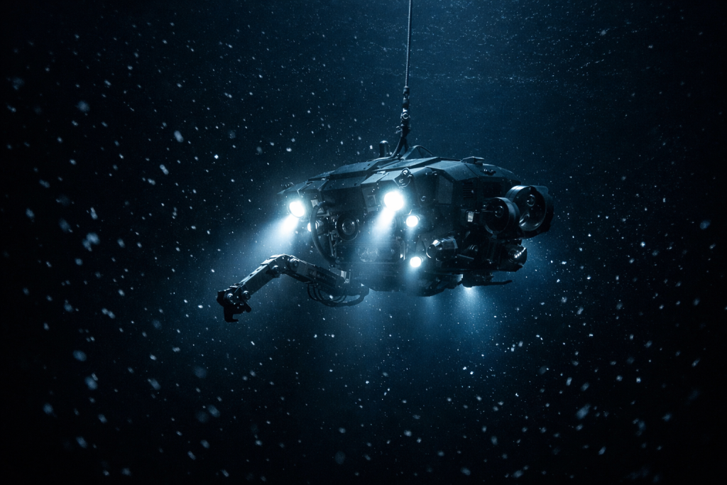
So what tools do scientists use to explore the ocean floor unexplored terrain? The main workhorses are ROVs (remotely operated vehicles) and AUVs (autonomous underwater vehicles). ROVs are tethered to ships and controlled by operators onboard. AUVs operate independently, running pre-programmed survey routes and returning to the surface when done.
Both are genuinely impressive. NOAA’s ROV Deep Discoverer has explored depths up to 6,000 meters. The Schmidt Ocean Institute’s ROV SuBastian — the same vehicle that captured the first-ever footage of a juvenile colossal squid in March 2025 — regularly dives to 4,500 meters. These machines carry HD cameras, sample collectors, and sonar arrays. They are technological marvels.
But they are also very slow and very expensive to operate. A single ROV dive costs tens of thousands of dollars. The ships that carry them cost hundreds of thousands of dollars per day to operate. And critically, ROVs can only cover a tiny patch of seafloor per dive. Sonar mapping — far faster than visual exploration — still requires ships to crisscross the ocean systematically, and the ocean is vast beyond intuition.
Sonar: Powerful but Limited
The main tool for mapping the ocean floor is multibeam sonar. Ships equipped with sonar arrays send out fans of sound pulses that bounce back from the seafloor, building up detailed depth charts. Modern multibeam systems are extremely accurate — but their resolution is limited by depth. In shallow water, you can resolve features less than a meter across. In the deep ocean, you might only resolve features 100 meters or larger. That’s the resolution Seabed 2030 is targeting for complete global coverage.
To map the entire remaining ocean floor with current ship-based sonar, estimates suggest it would take a single vessel roughly 200 years of continuous operation. That’s how large the task is.
Economic Barriers: Why Funding Doesn’t Flow to the Deep Sea
Here’s another uncomfortable truth about the ocean floor unexplored situation: money is as big a barrier as physics.
NASA’s annual budget hovers around $25 billion. NOAA’s entire budget — covering all ocean science, weather forecasting, fisheries management, and coastal research — sits at roughly $6 billion, and only a fraction of that goes toward deep-sea exploration. Space exploration gets roughly four times the national funding that all ocean science receives combined.
Why the gap? Partly it’s about visibility. Space looks spectacular on camera. Rocket launches are dramatic. Mars rovers send back photographs of alien landscapes. The deep ocean, by contrast, is dark, quiet, and logistically nightmarish to film. It is harder to make it feel immediate and exciting to a general audience.
There’s also a return-on-investment problem. The commercial applications of space exploration — satellites, communications, GPS, weather data — generate enormous economic value. The deep ocean’s economic potential, from deep-sea mining to pharmaceutical research, is massive but far less proven. Private investors are cautious. Government funding committees want clear deliverables.
Furthermore, the international nature of the ocean complicates things. No single country owns the deep ocean. Funding a comprehensive global mapping effort requires collaboration across dozens of nations with different priorities, budgets, and scientific traditions. The Seabed 2030 project — a collaboration between the Nippon Foundation and GEBCO — has brought over 185 organizations from across the world into a shared mission. That’s a remarkable achievement. But it also shows how complex the organizational challenge is when no single entity can simply write a check and get it done.
colossal squid in the wild — a century after the species was first identified.
Recent Breakthroughs: 2025 Changes Everything
Despite the obstacles, the pace of discovery is genuinely accelerating. The ocean floor unexplored frontier is slowly yielding to science, and 2025 has been a particularly remarkable year.
On World Hydrography Day 2025, the Seabed 2030 project announced that 27.3% of the world’s ocean floor has now been mapped to modern standards — with more than four million square kilometres of newly mapped seafloor added in the preceding year alone, an area roughly equivalent to the entire Indian subcontinent. Seabed 2030
Earlier in 2025, the project also published a landmark new version of the International Bathymetric Chart of the Arctic Ocean, adding 1.4 million square kilometres of mapping coverage — an area over three times the size of Sweden — to the global seafloor dataset. Seabed 2030
Perhaps most dramatically, the Schmidt Ocean Institute’s research vessel Falkor (too) achieved something scientists had waited a century to witness. Scientists captured the first confirmed footage of the elusive colossal squid in its natural environment — 100 years after the marine creature was first identified. The video shows a juvenile squid swimming at a depth of 600 meters near the remote South Sandwich Islands in the South Atlantic Ocean. CNN
Then there is the mysterious golden orb. During an expedition off the coast of Alaska, NOAA Ocean Exploration’s remotely operated vehicle discovered a mysterious golden orb 3,300 meters beneath the surface. Though scientists confirmed it was biological in origin, they were unable to identify it beyond that. Science Alert NOAA exploration coordinator Sam Candio summed up the moment perfectly: “Isn’t the deep sea so delightfully strange?”
In the Southern Ocean, researchers gathered nearly 2,000 specimens from 14 animal groups, found new hydrothermal vents over 2,000 feet deep, and discovered coral gardens alongside traces of explosive undersea volcanism — all within a single expedition. Smithsonian Magazine
Every single one of these discoveries came from a region of the ocean floor that had barely been visited before.
unexplored challenge — mapping vast stretches of seabed faster and cheaper than
ever before.
What We’re Missing: Cures, Climate Answers, and Hidden Species
Every time a research vessel dips below the waves for the first time in a new location, it finds something unknown. That pattern suggests the ocean floor unexplored zones hold far more than mystery — they may hold answers to some of humanity’s most pressing problems.
Medicine: Deep-sea organisms live under conditions that would kill most surface life. To survive crushing pressure, near-freezing temperatures, total darkness, and scarce nutrients, they have evolved unique biochemical adaptations. Scientists have already derived compounds from deep-sea organisms that show promise as anti-cancer agents, antibiotics, and antivirals. The cone snail, found in the shallows, produced a painkiller hundreds of times more potent than morphine. The deep ocean holds thousands of species with similar untapped potential — and we haven’t even identified most of them yet.
Climate science: The deep ocean plays a critical role in regulating Earth’s climate. It absorbs enormous quantities of heat and carbon dioxide from the atmosphere. But how it circulates that heat and carbon — through deep ocean currents called the thermohaline circulation — depends on seafloor geography we haven’t fully mapped. Without accurate maps, climate models run on incomplete data. Understanding the ocean floor is, therefore, directly connected to predicting climate change with accuracy.
Biodiversity: In deep-sea research, discovering multiple candidate new species in a short exploration window is not unusual — precisely because these ecosystems remain so poorly sampled. Scientific American Scientists estimate there could be anywhere from 500,000 to 10 million species living in the deep sea. So far, science has formally described only a tiny fraction of them. Each new expedition consistently discovers organisms that don’t fit any known category.
The deep ocean is also Earth’s largest continuous habitat by volume. When scientists measure living space in three dimensions, the ocean — particularly its depths — accounts for roughly 99% of all habitable space on Earth. And almost all of it is unknown.
The Future: AI Drones and the Race to Map the Abyss
The good news is that technology is finally catching up to the challenge. A new generation of tools is transforming what’s possible for ocean floor unexplored mapping missions.
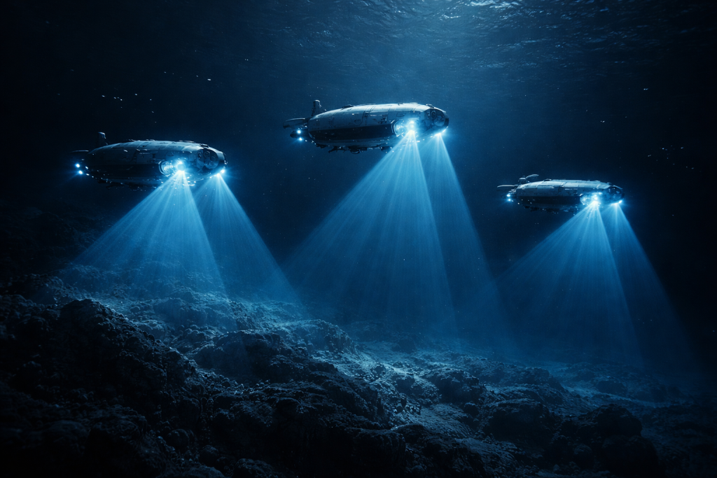
AI-powered AUVs are among the most exciting developments. Rather than following pre-programmed routes and returning blind to the surface, next-generation autonomous vehicles use artificial intelligence to make real-time decisions underwater. They can identify interesting features, adjust their path, collect targeted samples, and optimize their survey routes on the fly — without any human in the loop. Multiple AUVs can work in coordinated swarms, covering territory in parallel at a fraction of the time and cost of a single ROV.
Satellite altimetry offers another powerful shortcut. Tiny variations in the height of the ocean surface — caused by the gravitational pull of underwater mountains and trenches — can be detected by satellites. These gravity anomaly maps give scientists a rough sketch of what lies below, guiding where ships should go for detailed sonar surveys. It’s how researchers aboard the Schmidt Ocean Institute’s Falkor (too) located four previously unknown seamounts off the coast of South America, including one standing 2,681 meters tall and covering 450 square kilometres.
Crowdsourced data is also proving surprisingly valuable. Seabed 2030 accepts bathymetric data donations from commercial shipping vessels, cruise lines, fishing fleets, and sailing expeditions. Every ship that crosses the ocean with a properly equipped sonar system is potentially adding to the global map. Over the past year alone, Seabed 2030 welcomed contributions from 14 new organisations, including first-time contributions from five new countries: Comoros, Cook Islands, Kenya, Mozambique, and Tanzania. Seabed 2030
The goal is to complete a full map of the seafloor by 2030. Given that only 27.3% is done with just a few years remaining, that deadline looks ambitious. But the rate of progress is accelerating sharply. What took decades to accumulate before 2017 is now being added in single years. New technologies, new partnerships, and new political will — driven by the UN Ocean Decade framework — are changing the math dramatically.
[internal link: suggested topic — link to FactoPiaX’s post on deep sea creatures and secrets] — go to https://factopiax.com/blog/ and find the exact post link for related posts.

has been searching for — if we can reach them in time.
Frequently Asked Questions
Why is the ocean floor unexplored if we have such advanced technology?
The main barriers are physics, cost, and logistics — not a lack of ambition. Deep-sea pressure at the ocean’s greatest depths reaches over 1,000 times the pressure at sea level, which destroys conventional materials and equipment. Radio signals don’t travel through seawater, eliminating wireless communication. Ships must physically crisscross the ocean to map it by sonar — and with an area larger than all continents combined, that takes enormous time and money. Current estimates suggest full mapping would take a single ship roughly 200 years working non-stop.
What percentage of the ocean floor has been explored in 2025?
As of June 2025, the Seabed 2030 project confirmed that 27.3% of the ocean floor has been mapped to modern sonar standards. However, visual exploration — actually seeing the seafloor with cameras or human eyes — covers only about 0.001% of the deep seafloor. The difference between “mapped” and “explored” is enormous.
Is it true we know more about Mars than the ocean floor?
Yes, and it’s not just a figure of speech. We have produced higher-resolution maps of the surface of Mars, the Moon, and Venus than we have of large portions of Earth’s own ocean floor. NASA’s Mars orbiters have mapped the planet at resolutions of under 1 meter per pixel. Most of Earth’s deep ocean floor has never been imaged at all.
What is the Seabed 2030 project?
Seabed 2030 is a global initiative by the Nippon Foundation and GEBCO (the General Bathymetric Chart of the Oceans) with the goal of producing a complete, high-resolution map of the entire ocean floor by the year 2030. It operates as a flagship programme of the United Nations Ocean Decade. Over 185 organisations worldwide now contribute data to the project, which is freely and publicly available through the GEBCO Ocean Map.
What might we find in the unexplored ocean floor?
The honest answer is: we don’t fully know, and that’s the point. Past explorations of new deep-sea areas have consistently found previously unknown species, new geological formations like hydrothermal vents and seamounts, and biological compounds with medical potential. Scientists estimate between 500,000 and 10 million species may live in the deep sea. There are also ancient geological records locked in deep-sea sediments, untapped mineral deposits, and climate data embedded in deep ocean currents — none of which we can fully access without mapping and exploring the seafloor first.
Conclusion
There’s something humbling about the ocean floor unexplored reality. We are a species that has landed robots on comets, photographed black holes 55 million light-years away. We sequenced the human genome — and yet the largest habitat on our own planet remains, for the most part, a blank page. Not because we lack curiosity, but because the deep ocean is genuinely, brutally hard to reach. The pressure would crush us. The darkness would blind us. The scale would defeat any single effort.
But 2025 has shown us something important. With coordinated international effort, AI-driven technology, and the quiet determination of thousands of scientists and engineers around the world, that blank page is slowly being filled in. Every new dive by an ROV, every sonar pass by a ship, every data donation from a cargo vessel crossing the Pacific adds one more detail to humanity’s picture of its own home planet.
The discoveries waiting down there — the species, the medical compounds, the climate secrets, the sheer geological wonder. These make this one of the most important scientific endeavors of our time. And the story is just beginning.
Want to go deeper into the mysteries of our oceans? Explore more mind-blowing content at FactoPiaX and subscribe to the FactoPiaX YouTube channel for videos that turn your curiosity into knowledge.
Discover more from Factopiax
Subscribe to get the latest posts sent to your email.