

If you’ve ever watched a weather app update overnight and thought, “How do they know that?”—you’re already halfway to understanding one of science’s most frustrating unsolved problems. Why can’t we predict volcanic eruptions the way we predict weather? It’s a question millions of people ask every year, especially those living in volcano-prone regions like Japan, Indonesia, the Philippines, Italy, and the Pacific Northwest of the US. The short answer is that volcanoes are far more complex, far more individual, and far more secretive than the atmosphere above our heads. But the real story is much more interesting than that — and a recent, real-world prediction failure makes the perfect way into it.
The Axial Seamount Experiment: When Scientists Got It Wrong (and Why That’s Actually Brilliant)
At the end of 2024, a team of researchers led by geophysicist William Chadwick at Oregon State University’s Hatfield Marine Science Center made a bold, public prediction. Axial Seamount — an underwater volcano sitting roughly 300 miles off the Oregon coast, nearly a mile beneath the Pacific Ocean — would erupt before the end of 2025.
The volcanic activity coming from Axial Seamount in 2025 had scientists predicting an impending eruption. However, recent research and changes in volcanic activity now have scientists predicting it will erupt sometime in 2026. AOL
So why were they so confident in the first place? Because Axial is extraordinary. It is “the most well-instrumented submarine volcano on the planet,” according to geophysicist Mark Zumberge of Scripps Institution of Oceanography. The volcano has erupted three times in the last 30 years. In 1998, 2011, and 2015 — giving scientists a pattern to work with. One of the signs pointing to a 2025 eruption was that the volcano had reached the same inflation levels as before its 2015 eruption, back in January. But as of mid-2025, the rate of inflation had been slowly decreasing all year. IFLScienceYahoo!
Scientists haven’t yet come up with a reliable way to forecast a volcanic eruption, particularly not months or years in advance. Researchers hoped they had identified the right pattern of data to anticipate Axial’s eruption — but that prediction proved premature. The main forecasting method used was based on a repeating pattern of inflation and deflation, in which each eruption is triggered at or near the previous inflation threshold. This approach actually worked for the 2015 eruption, but the rate of inflation has since been highly variable, which has thwarted forecasting attempts. Science NewsOregonstate
Chadwick called the whole endeavour what it truly was: an experiment and a learning experience — a test of how far scientists can push the envelope of long-term eruption forecasting. That intellectual honesty is what makes science remarkable. The failed prediction isn’t embarrassing — it’s data. Oregonstate
Why Each Volcano Is a Unique Puzzle
Here is the key difference between predicting weather and predicting volcanic eruptions: the atmosphere follows laws that apply everywhere on Earth simultaneously. Temperature, pressure, humidity — these interact through physics that repeat, globally, every single day. Meteorologists build models on decades of consistent, comparable data.
Volcanoes don’t work that way. Every volcano has its own geology, its own history of eruptions, its own plumbing system of magma chambers and fault networks buried kilometres underground. What makes Kilauea in Hawaii rumble before an eruption is not what makes Stromboli in Italy erupt, or what signals an explosion at Mount Merapi in Indonesia. They are, in a very real sense, individuals. And you cannot generalise across individuals the way you can generalise across atmospheric systems.
Furthermore, most volcanoes don’t erupt frequently enough to build a useful historical record. Many volcanoes, particularly those that erupt violently, have had limited or no historical eruption observations and few quantitative measurements. If a volcano last erupted 400 years ago, scientists have almost no baseline for what “normal unrest” looks like before a major event at that specific vent. Is that earthquake swarm normal background noise, or the opening act of a disaster? Without decades of monitoring data at that specific volcano, it’s genuinely impossible to say. National Academies
That individual nature of each volcano is precisely why predictions remain so difficult — and why the scientific community continues to invest in long-term, continuous monitoring of specific volcanoes like Axial.
The Three-Part Challenge: If, When, and How Big
When scientists try to predict volcanic eruptions, they’re not actually solving one problem. They’re solving three separate problems simultaneously, and each one is brutally hard on its own.
Will It Erupt At All?
The first question is whether a volcano showing signs of unrest will actually go on to erupt. Volcanoes can rumble, shake, inflate, and belch gases for months — or even years — without ever erupting. This is called volcanic unrest, and it is exceedingly common. Distinguishing genuine pre-eruptive signals from long-term unrest that fizzles out requires deep knowledge of that specific volcano’s character. Without a long monitoring history, scientists are essentially reading a book with most of the pages missing.
When Will It Happen?
Even if scientists are confident an eruption is coming, pinning down the when is where forecasting gets truly humbling. The Axial Seamount case illustrates this perfectly. The inflation threshold was real. The seismic signals were real. In June 2025 alone, more than 2,000 earthquakes were recorded near Axial Seamount in a single day — a sign that an eruption might be imminent. But “imminent” in geological terms can still mean months away. The underground systems that drive eruptions operate on timescales that don’t care about human calendars. Yahoo!
How Large Will It Be?
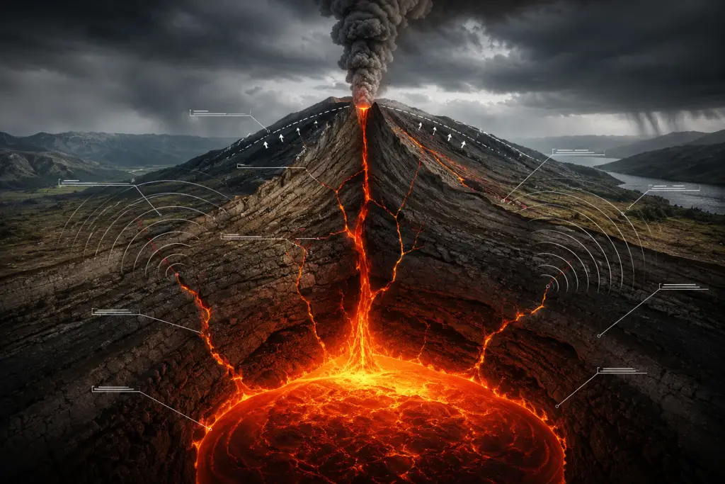
Even if scientists know a volcano will erupt and roughly when, the magnitude of the event adds another layer of uncertainty. A volcano can produce a minor lava flow that barely disrupts local life, or it can generate a cataclysmic explosive eruption that darkens skies across continents. The size depends on how much magma has accumulated, its gas content, the geometry of the vent system, and how much resistance the rock overhead provides — all factors that are extraordinarily difficult to measure from the surface.
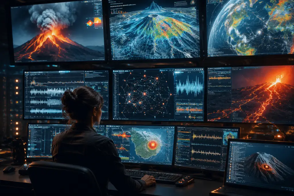
What We Can Actually Measure — and Why It’s Still Not Enough
Scientists are not flying blind. There is a sophisticated, and growing, toolkit for monitoring volcanic unrest. Understanding what we can measure helps explain why we still can’t predict eruptions with confidence.
Seismic Monitoring
Earthquakes are the most reliable early warning signal available. As magma moves through rock, it fractures the surrounding geology, producing characteristic seismic signatures. Volcano observatories worldwide — including the USGS Volcano Hazards Program — monitor seismic networks around active volcanoes continuously. Swarms of small earthquakes often precede eruptions. But seismic activity can also occur without any eruption following.
Ground Deformation
When magma accumulates underground, it pushes the surrounding rock outward. GPS instruments and satellite radar (InSAR technology) can detect ground swelling or subsidence with millimetre-level precision. Inflation in an underwater volcano happens when magma accumulates below the seafloor and pushes the surface of the volcano upward. At Axial, this inflation data was central to the 2025 prediction — and the variable rate of inflation is exactly what caused the forecast to slip. AOL
Gas Emissions
Rising magma releases dissolved gases — primarily sulphur dioxide (SO₂), carbon dioxide (CO₂), and water vapour. Measuring the volume and ratio of these gases at a volcano’s summit gives scientists a window into what the magma is doing at depth. A sharp spike in SO₂ emissions is often one of the strongest short-term eruption precursors available.
All three data streams together still only give scientists a probabilistic picture. The underground systems connecting these signals to an actual eruption are hidden from direct observation — and that invisibility is the core of the problem.
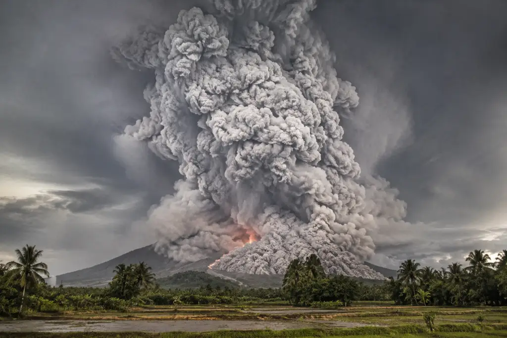
The Mt. Pinatubo Success Story: Proof That Forecasting Can Save Lives
If the Axial Seamount story highlights the limits of volcanic prediction, then the 1991 eruption of Mount Pinatubo in the Philippines represents its greatest triumph — and a powerful demonstration of why the science matters.
The collaborative work of scientists from the U.S. Geological Survey (USGS) and the Philippine Institute of Volcanology and Seismology (PHIVOLCS) saved more than 5,000 lives and $250 million in property by forecasting Pinatubo’s climactic eruption in time to evacuate local residents and the U.S. Clark Air Force Base, situated only 9 miles from the volcano. U.S. and Filipino scientists worked with military commanders and public officials to put evacuation plans in place and carry them out 48 hours before the catastrophic eruption. USGS
The success at Pinatubo was not a miracle. Filipino scientists surveyed the volcano by helicopter after local residents reported earthquakes, noted new gas vents, and installed monitoring equipment that immediately registered high rates of seismic activity. Recognizing the threat, they invited USGS scientists from the Volcano Disaster Assistance Program to advise. The team installed additional monitoring equipment and studied previous eruption deposits, quickly amassing strong evidence that previous eruptions were infrequent but large. National Academies
The evacuation in the days before the eruption certainly saved tens of thousands of lives, and has since been hailed as a great success for volcanology and eruption prediction. Wikipedia
The Pinatubo success relied on a lucky convergence: enough warning time, a rapidly escalating sequence of signals, and crucially, decision-makers who trusted the scientists. It also showed that short-term forecasting — days to weeks — is far more achievable than the months-to-years timescales scientists are attempting with Axial. However, the lesson holds: even imperfect forecasting, when acted upon, saves lives.
[internal link: suggested topic — your post about natural disasters or geological hazards] go to https://factopiax.com/blog/ and find the exact post link for related posts.
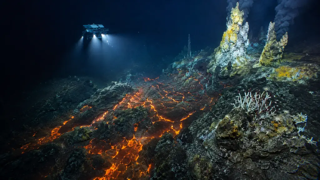
Why Underwater Volcanoes Are Actually Easier to Study
This might seem counterintuitive. Axial Seamount sits nearly 1,500 metres under the Pacific Ocean, and yet it is one of the most intensively monitored volcanoes on Earth. How does that make sense?
The answer is pressure — social and political pressure, not geological pressure. When scientists monitor a land-based volcano and predict an eruption, there are immediate, enormous consequences. Communities must be evacuated. Tourism collapses. Governments face pressure to act — or to ignore warnings in order to avoid economic disruption. The human stakes distort decision-making at every level.
Axial Seamount has no permanent population to evacuate. There are no farms, no homes, and no roads above it. The reason anyone felt able to make a public statement about Axial’s potentially imminent eruption was simple: as a huge, active, and overall unusual volcano, scientists just have far more information about it than most others. The lack of evacuation pressure creates a rare scientific freedom — the ability to make a public prediction, watch it fail, analyse why, and update the model without anyone losing their home. IFLScience
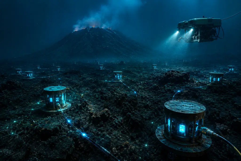
Researchers at OSU’s Hatfield Marine Science Center have been continuously monitoring Axial in real time using the Regional Cabled Array, an ocean observatory that uses approximately 660 miles of undersea cables to monitor activity with more than 140 instruments. That infrastructure is extraordinary. Most land volcanoes in developing nations have a fraction of that monitoring coverage — and those are precisely the volcanoes nearest to the highest-risk populations. The Axial experiment, therefore, is not just about one underwater volcano. It is a test of the methodology that will eventually be applied everywhere. AOL
[internal link: suggested topic — your post about ocean exploration or deep sea discoveries] go to https://factopiax.com/blog/ and find the exact post link for related posts.
The Future of Volcanic Forecasting: AI, Physics Models, and Real-Time Networks
The gap between weather forecasting and volcanic eruption prediction is narrowing — slowly, but meaningfully. Three developments in particular are changing the landscape.
Real-Time Monitoring Networks
The Regional Cabled Array at Axial is the blueprint for next-generation volcanic monitoring. Continuous, multi-sensor data streams — seismic, deformation, gas, temperature — feed into research systems in real time. As more volcanoes receive this level of attention, the historical datasets needed for meaningful pattern recognition will start to accumulate.
AI and Machine Learning
Artificial intelligence is beginning to find eruption precursors in seismic data that human analysts miss. Machine learning models can process thousands of hours of seismic recordings and identify subtle signal patterns that correlate with past eruptions. The Axial Seamount Eruption Forecasting Experiment, launched in 2026, is a real-time initiative designed to test the predictability of volcanic eruptions through a transparent, physics-based framework — exactly the kind of open-science approach that will accelerate the field. The transparent, publish-as-you-go nature of the Axial experiment is itself a model for how volcanic science should operate. arxiv
Physics-Based Models
Beyond pattern matching, researchers are building physics-based models of magma behaviour — simulating how pressure, temperature, and rock strength interact inside a volcano. These models are computationally demanding, but as computing power grows, they offer the prospect of genuine mechanistic understanding, rather than statistical guesswork.
Weather forecasting took more than a century of global data collection, model development, and satellite technology to reach the accuracy we enjoy today. Volcanic eruption prediction is earlier in that journey — but it is absolutely on the same path.
Frequently Asked Questions
Why can’t we predict volcanic eruptions like weather forecasts?
Weather prediction relies on atmospheric patterns that repeat globally across comparable conditions. Volcanic eruptions, by contrast, depend on the internal geology of each individual volcano — hidden magma chambers, unique rock structures, and variable rates of magma supply that differ from one volcano to the next. There is no global “volcanic weather” to model, and most volcanoes lack the decades of dense monitoring data that make weather models accurate.
What is the Axial Seamount, and why does it matter for volcanic prediction?
Axial Seamount is an active underwater volcano located approximately 300 miles off the Oregon coast on the Juan de Fuca Ridge. It is the most heavily instrumented submarine volcano in the world, making it the centrepiece of an ongoing scientific experiment to push the boundaries of long-term eruption forecasting. Its recurring eruption cycle — in 1998, 2011, and 2015 — gives scientists a rare pattern to analyse, even if that pattern has proven harder to extrapolate than expected.
What signals do scientists monitor before a volcanic eruption?
Volcanologists monitor three main categories of signals: seismic activity (small earthquakes caused by magma fracturing rock), ground deformation (inflation or deflation of the volcanic surface measured by GPS and satellite radar), and gas emissions (particularly sulphur dioxide, which increases sharply as magma rises toward the surface). Together, these signals can indicate that a volcano is entering a period of heightened unrest — but translating unrest into a precise eruption timeline remains a major scientific challenge.
Has any volcanic eruption ever been successfully predicted?
Yes — the 1991 eruption of Mount Pinatubo in the Philippines is the most celebrated example. Scientists from the USGS and the Philippine Institute of Volcanology and Seismology monitored the volcano’s escalating seismic activity and gas emissions over several weeks and issued timely warnings. The resulting evacuation saved more than 5,000 lives and protected hundreds of millions of dollars in property. Shorter-term forecasts — in the range of days to weeks — have been achieved at several volcanoes, but months-ahead predictions remain an active area of research.
Will AI ever allow us to predict volcanic eruptions accurately?
Artificial intelligence is already improving the detection of subtle pre-eruptive patterns in seismic data that human analysts might miss. Combined with physics-based models and real-time monitoring networks, AI has genuine potential to narrow the gap between what volcanologists observe and what they can forecast. However, the fundamental challenge — the deep variability and individuality of each volcano — means that AI will augment human expertise rather than replace the need for long-term, volcano-specific data collection.
Conclusion
The story of Axial Seamount’s missed 2025 eruption is not a story about scientists getting it wrong. It’s a story about the frontier of human knowledge, pushed as far as it can currently go — and then pushed a little further. We can’t predict volcanic eruptions with the precision we apply to tomorrow’s weather because volcanoes are not the atmosphere. They are ancient, individual, and largely hidden from view, each one guarding its own timetable deep beneath the Earth’s crust.
But the tools are improving. The monitoring networks are expanding. The AI models are learning. And the transparent, experiment-based approach pioneered at Axial Seamount is exactly the kind of scientific culture that leads to breakthroughs. Every failed prediction refines the next attempt. Every data point adds to a picture that future volcanologists will use to save lives we’ll never know were at risk.
That’s how science actually works — not in single eureka moments, but in the steady, humble accumulation of better understanding. And that, arguably, is more awe-inspiring than a perfect forecast would ever be. If you want to go deeper into the world’s most extraordinary geological phenomena, explore more at FactoPiaX — and watch our channel at youtube.com/@factopiaxs for more stories like this one.
Discover more from Factopiax
Subscribe to get the latest posts sent to your email.